Maps
How can we help you?
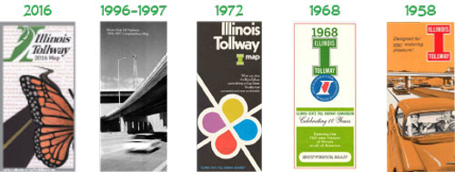
Download Illinois Tollway Maps
| Tollway System Map - Issued 2016 (Side 1) |
| Tollway System Map with Rates* - Issued 2016 (Side 2) |
*Refer to the Rates by Toll Plaza chart for most current rates.
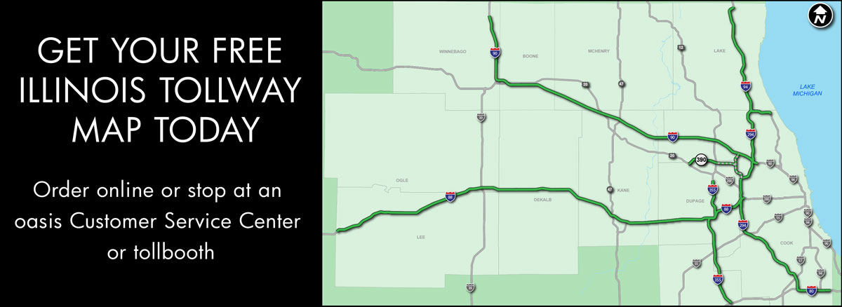
Get a Free Illinois Tollway Map
| Order online |
| Stop at an oasis Customer Service Center or any tollbooth |
More Illinois Tollway Maps
| 2016 Tollway Construction map |
| Entrances and Exits |
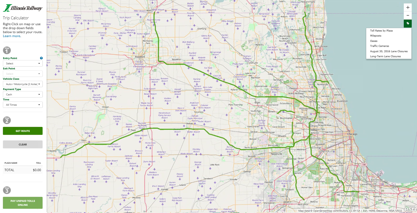
| Interactive Tollway Map |
The Interactive Tollway Map
Illinois Tollway Virtual Map is an interactive map designed to assist customers in finding location-specific information, including;
Legal Disclaimer
This trip calculator is intended for informational purposes only. The results of your inquiry represent the anticipated tolls you will be required to pay based upon the information you supplied. While every attempt has been made to ensure that these results are accurate and reliable, the Illinois Tollway recognizes that human and/or mechanical errors are possible. Accordingly, the Illinois Tollway, on its own behalf and on behalf of its employees, officer and agents makes no representation as to the accuracy, completeness or suitability of the information provided herein and denies any express or implied warranty of the same.
this is a title
This is a column
¿¿¿¿¿¿¿
Traffic Cameras
The Illinois Tollway Virtual Map allows customer to select from 21 camera locations throughout the Illinois Tollway system and view current roadway images. Most cameras offer customers multiple roadway views for each location.
Click on the "Traffic Cameras" tab located in the left navigation bar on the Illinois Tollway Virtual Map to identify camera locations.
Camera images are uploaded approximately every five minutes, and viewers must refresh the page to view updates. Image quality is dependent on weather conditions.
Trip Calculator
The Trip Calculator determines toll payments and locations on the Illinois Tollway based on routes customized by Tollway customers. Simply enter your trip start and end points, vehicle type, payment type and the Trip Calculator provides: the trip route, name and location of each toll plaza along the route, a list of all toll rates for each toll plaza, and the total toll amount for the designated trip.
If you are using the Trip Calculator to determine toll amounts or locations to make an unpaid toll payment, make a note of the toll plaza names and numbers along your route and then click the "Pay Unpaid Tolls Online" button to the left of the map.
Toll Rates by Plaza
The Illinois Tollway collects tolls at both mainline and ramp toll plazas throughout the Tollway system. Toll Rates by Plaza identifies the location and toll rates for all toll collection points on the system. Each location is identified by a toll plaza number. Clicking on a specific toll plaza icon will provide details including plaza number, location and the passenger vehicle toll rate for both I-PASS and cash customers. A link to the full toll rate chart for all vehicles, as well as a link to pay unpaid tolls online are also offered.
Mileposts
Milepost signs are located every quarter mile along the Illinois Tollway system and identify the interstate designation, direction of travel, as well as the milepost number. These signs provide customer assistance and help emergency responders better identify locations on the Illinois Tollway.
Oases
Seven Illinois Tollway oases are located along the Tollway system and provide customers with fuel and a variety of services and food options. Each oasis is identified on the Illinois Tollway Virtual Map by a fuel and food icon that provides the name and location of the oasis and a link to a detailed list of tenants and hours of operation.
Daily Lane Closures
Daily Lane Closures are posted each week day and provide drivers with a list of temporary lane and shoulder closures and long-term closures by roadway. All closures are subject to weather conditions.
Entrances and Exits
View a detailed list of all entrances and exits organized by roadway.
Jane Addams Memorial Tollway (I-90)
Entrance/Exit Location
Tolled Entrance/Exit Location
|
|
|
Westbound |
Eastbound |
||
|---|---|---|---|---|---|
|
Interchange |
Plaza No. |
On |
Off |
On |
Off |
| Rockton Road | - | ||||
| Illinois Route 173 | 4 | ||||
| East Riverside Boulevard | 2 | ||||
| Business U.S. Route 20, Rockford | - | ||||
| Cherry Valley, I-39 | - | ||||
| Irene Road | 5a | ||||
| Genoa Road | 3 | ||||
| U.S. Route 20 (at Marengo-Hampshire) | - | ||||
| Illinois Route 47 | 6 | ||||
| Randall Road | 8 | ||||
| Illinois Route 31 | 11 | ||||
| Illinois Route 25 | 13 | ||||
| Beverly Road | 16b | ||||
| Illinois Route 59 | 14 | ||||
| Illinois Route 59 | 16a | ||||
| Barrington Road | 10 | ||||
| Roselle Road | 12 | ||||
| I-290, Illinois Route 53 | 15 | ||||
| Arlington Heights Road | 18 | ||||
| Elmhurst Road | - | ||||
| Lee Street, Illinois Route 72 | - | ||||
| Devon Avenue | - | ||||
| O'Hare International Airport | - | ||||
| Tri-State Tollway (I-294) | - | ||||
| I-90 (Kennedy Expressway) | - | ||||
Reagan Memorial Tollway (I-88)
Entrance/Exit Location
Tolled Entrance/Exit Location
|
|
|
Westbound |
Eastbound |
||
|---|---|---|---|---|---|
|
Interchange |
Plaza No. |
On |
Off |
On |
Off |
| I-290 (Eisenhower Expressway) | - | ||||
| I-294, Southbound (Tri-State Tollway) | - | ||||
| I-294, Northbound (Tri-State Tollway) | - | ||||
| York Road | - | ||||
| Spring Road (22nd Street) | 53 | ||||
| Illinois Route 83 | 54 | ||||
| Midwest Road | 55 | ||||
| Highland Avenue | 56 | ||||
| Highland Avenue (Downers Grove) | 56 | ||||
| I-355 (Veterans Memorial Tollway) | - | ||||
| Ogden Avenue (U.S. Route 34) | 81 | ||||
| Illinois Route 53 | - | ||||
| Naperville Road | 57 | ||||
| Winfield Road | 58 | ||||
| Illinois Route 59 | - | ||||
| Eola Road (I-PASS/E-ZPass Only) | 60 | ||||
| Farnsworth Avenue | 59 | ||||
| Illinois Route 31 | 63 | ||||
| Orchard Road | 64 | ||||
| Illinois Route 56 to U.S. Route 30 and Illinois Route 47 | - | ||||
| Illinois Route 47 | - | ||||
| Peace Road | 65 | ||||
| Annie Glidden Road | 67 | ||||
| I-39, U.S. Route 51, Rockford | - | ||||
| Illinois Route 251, Rochelle | - | ||||
| U.S. Route 30 | - | ||||
Tri-State Tollway (I-94/I-294/I-80)
Entrance/Exit Location
Tolled Entrance/Exit Location
|
|
|
Westbound |
Eastbound |
||
|---|---|---|---|---|---|
|
Interchange |
Plaza No. |
On |
Off |
On |
Off |
| Russell Road | - | ||||
| Old U.S. Route 41 | - | ||||
| Rosecrans Road (Illinois Route 173) | - | ||||
| Grand Avenue (Illinois Route 132) | - | ||||
| Milwaukee Avenue (Illinois Route 21) | - | ||||
| Belvidere Road (Illinois Route 120) | - | ||||
| Buckley Road (Illinois Route 137) | 20 | ||||
| Rockland Road | - | ||||
| Townline Road (Illinois Route 60) | 22 | ||||
| Half Day Road (Illinois Route 22) | 23 | ||||
| Deerfield Road | - | ||||
| Lake Cook Road | 26 | ||||
| I-94 (Edens Spur) | - | ||||
| Waukegan Road (Illinois Route 43), Edens Spur | - | ||||
| Willow Road | 27 | ||||
| Golf Road (Illinois Route 58) | 28 | ||||
| U.S. Route 12-14, Dempster Street | - | ||||
| Touhy Avenue | - | ||||
| O'Hare West, I-90, I-190, U.S. Route 12-45 | 31 | ||||
| O'Hare East, I-190, U.S. Route 12-45, River Road | 32 | ||||
| Balmoral Avenue | 30 | ||||
| Irving Park Road (Illinois Route 19) | - | ||||
| I-290, U.S. Route 20, Lake Street, Illinois Route 64 | - | ||||
| I-290 (Eisenhower Expressway) | - | ||||
| I-88 (Reagan Memorial Tollway) | - | ||||
| Roosevelt Road (Illinois Route 38) | - | ||||
| Cermak Road | - | ||||
| I-88 (Reagan Memorial Tollway) | - | ||||
| Ogden Avenue (U.S. Route 34) | - | ||||
| Wolf Road | - | ||||
| I-55 (Stevenson Expressway) | 37 | ||||
| 75th Street, Willow Springs Road | 34 | ||||
| Archer Avenue/LaGrange Road | - | ||||
| U.S. Route 12-20, 95th Street | 38 | ||||
| Cicero Avenue (Illinois Route 50), 127th Street | - | ||||
| 147th Street | 42 | ||||
| I-57 | 42 | ||||
| U.S. Route 6, 159th Street | 40 | ||||
| I-80, Westbound | 43 | ||||
| I-80, Eastbound | 45 | ||||
| Dixie Highway | - | ||||
| Wood Street | - | ||||
| Halsted Street (Illinois Route 1) | 47 | ||||
| I-80/I-94, Illinois Route 394 | - | ||||
Veterans Memorial Tollway (I-355)
Entrance/Exit Location
Tolled Entrance/Exit Location
|
|
|
Westbound |
Eastbound |
||
|---|---|---|---|---|---|
|
Interchange |
Plaza No. |
On |
Off |
On |
Off |
| Army Trail Road | - | ||||
| North Avenue (Illinois Route 64) | 75 | ||||
| Roosevelt Road (Illinois Route 38) | 77 | ||||
| Butterfield Road (Illinois Route 56) | 79 | ||||
| I-88 (Reagan Memorial Tollway) | - | ||||
| Ogden Avenue (U.S. Route 34) | - | ||||
| Maple Avenue | 83 | ||||
| 63rd Street | 85 | ||||
| 75th Street | 87 | ||||
| Boughton Road | 90 | ||||
| I-55 | - | ||||
| 127th Street | 93 | ||||
| Archer Avenue/143rd Street | 95 | ||||
| Illinois Route 7 (159th Street) | 97 | ||||
| U.S. Route 6 | 101 | ||||
| I-80 | - | ||||


